Survey It Right
- Carol Mckee
- Aug 21, 2022
- 8 min read
When you build a Passive House a lot of the things needed for the project are behind the scenes actions. Unless you are involved in it you would really have no idea that some things are vital to the success of the build. Once you know some of these things it then all makes sense. But to the casual observer you might not have any idea how much behind-the-scenes work is done.
The house placement survey is one of those things. This is different than surveying the lot boundaries. In order to make sure that we locate the house correctly the property must be surveyed specifically placing the house on the lot exactly where the permitting office wants it to go in order to comply with the setbacks specified by the town or county. If you are building on a large enough lot that you are no where near the setback lines, maybe you could skip this step, because if it shifts a foot this way or a foot that way, not as big a deal. But if you setback lines are close to the house this step is vital.
On this passive house build we are right at the front setback lines, so there is no room for error. In addition the orientation of the garage and the house in relation to each other also matters quite a lot. Since the two are not connected we are basically building two different structures and you want to make sure you get the relationship to them correct. That’s a long way of explaining that we absolutely had to get a house placement survey done before we did any excavation.
The county required that we revise our plans because a tiny corner of the garage was on the set back line. This meant we had to get back on the architect's schedule to have the plans shifted enough to satisfy the permit office. Then we had to go through permitting review again and all that added in several weeks of delay until we got approval. We then sent the revised plans over to the surveyor who is responsible for plotting out exactly where on the lot the house and garage go. There was then a back-and-forth with the surveyor and the architect, as there were some minor discrepancies or disconnects or changes needed to be made between the house and the garage. I was grateful that the surveyor caught some of the things that had slipped through the cracks.

Once we had the final plans of how the buildings were going to plot out, it took a few weeks to get on their schedule. That wasn’t necessarily bad, because we experienced yet more delays on the permitting process and it was better to have the survey done once the permit was approved. So it all worked out well in the end.
I arrange to meet the survey field crew out at the job site. I didn’t know it at the time, but that is quite unusual and the field team actually appreciated my level of interest. Having not gone through this specific experience before I was trying to be a sponge and absorb as much as I could.
They started out by locating reference points both on the property and on the adjoining property. They are stakes in the ground that have been pre-determined and exact location, and these stakes are then triangulated to create a known reference point on the property that they use to lay at the house.
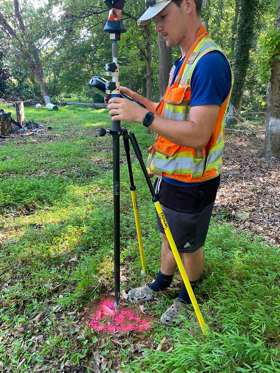
Wow is this a cool process. We’ve all seen the surveyors out with the tripods and looking through something and shooting at another target and such, but I don’t know how many of us really understand what they’re doing. This process took that to a whole new level. They have what they call the shooter, that is basically a computer on a tripod that shoots and reads laser images and they have another tripod with another computer on it that receives the signals as well as communicates with the shooter. The shooter looks like a mini version of something out of the movie "Robocop". Once the two computers are communicating, the shooter is spinning around, re-centering, shooting again, spinning aroundm re-centering and such, all to make sure that it is triangulating correctly with the receiver.
It starts out slow at first, because they’re plotting around the property trying to find these reference points that are basically large nails or pieces of rebar in the ground that have a faded number on them that they’re trying to interpret, and I’m thinking to myself “this is going to take forever.” They find a reference point towards the front right side of the property and then another reference point towards the middle right side of the property and they find the corner of the property on the far left side.
Using those as all reference points the survey crew then creates a central reference point in a spot where they have mostly clear line of sight. Clear line of sight not just to one or two spots rather they are trying to get a clear line of sight to all of the reference points on the drawing. These points are basically in any corner of the house foundation. That’s central reference point they named an arbitrary number of 10,000. Not only will they use it now, but when they come back out later points, they will re-establish that Mark of 10,000, using the same type of triangulation process, so that way they can be checking things afterwards. There will be more visits from the survey field crew as we go through this process. How many times we have the surveyors out here has yet to be determined but it looks to be at least three times.
Once they have that 10,000 point established, they are now looking to place each and every corner of the house. Wherever the house changes direction, there is a reference point at that change. This house does not have an extreme amount of planes that change, but there were still a fair amount of reference points. For example if the foundation recesses back for an 8 foot width, allowing for a stairwell outside, you would have to mark each corner of that recess. However if the side of the house is just one plain, then they only marked the corners. So a long wall would have two reference points, and a wall with a setback for a stairwell could have six or more reference points.
So they pick a point, and start their period on our drawings, that point was labeled 100. The next point was 101, then 102, etc. I think there were about 24 points between the house and the garage, so not many, and not as many as I might’ve expected. Now you might expect that they’re looking at the drawing and trying to approximate where that spot is, and going over to that spot. Not exactly. What they did is they watched the receiver computer and it was like the kids game of hide and go seek and you’re getting warmer. The computer would guide him to the next spot because it was already programmed into both computers, and then when he was pretty close he would set the tripod down.

Let me define pretty close. When he set the main point down, it basically is a poll that is got a level on it, so he knows when he is completely perpendicular, and two legs that come off at angles, to give stability. Those legs are adjustable to allow him to fine-tune it. Pretty close, is within about a quarter of an inch on the entire lot.! Then they fine-tunes with adjusting those two legs to make it level and shift around a little based on the readings that they are getting, and then he gets an accuracy of .000XX X. So another words, he is accurate down to the thousand percentage of an inch. I chuckled when he described it as he’s within a gnats width of being exact. It is that precise, which is truly amazing.
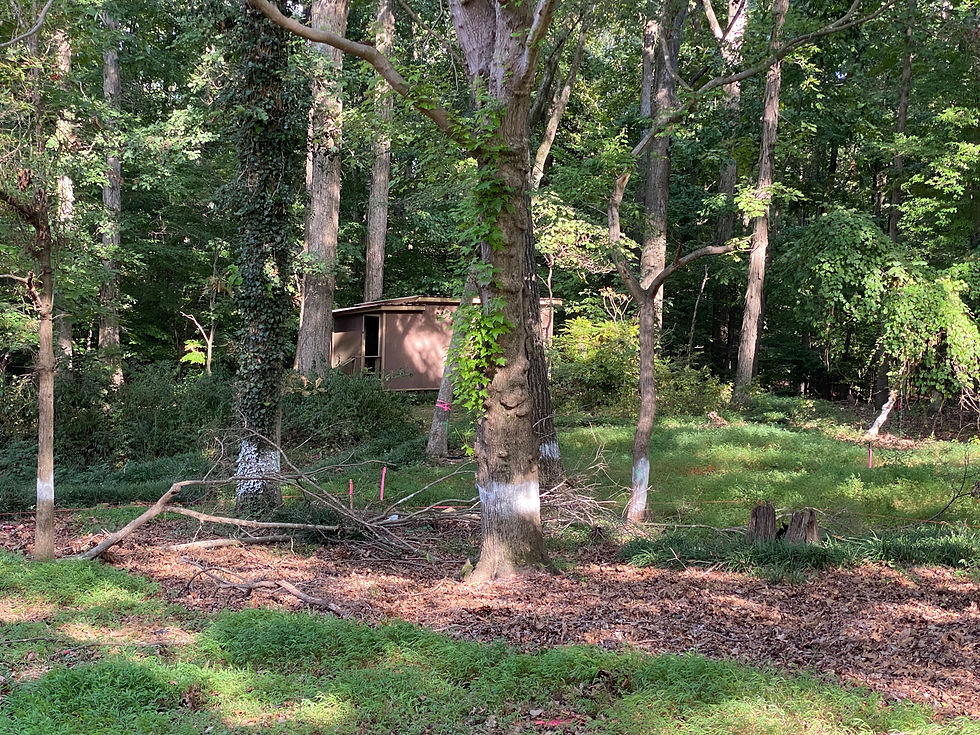
Once they had spot number 101 done, they were just use the computer on the receiver, like a divining rod to find water, to find the next spot. They didn’t even carry the drawing around with them, if they had any question, they would go over to where the drawing was on the table I set up, look at it, and then go back. They took a methodical clockwise pattern and marked each point. A coupled of these ended up in interesting places such as right where a tree sits and another in the ruins of the previous structure.
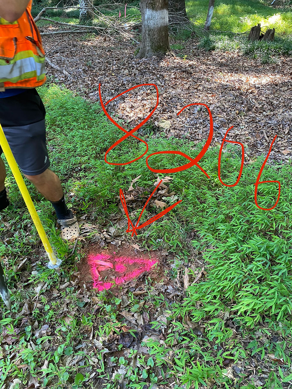
The crew member with the receiver would get that center pole that was exactly perpendicular, exactly where it needed to be. And then he would drive it down into the ground to create an impression, like a spearpoint. Another crew member would then take a wooden stake and put initials on it whether it was GC for garage corner or HC for house corner, or sometimes they didn’t label it at all, and they would then drive the state down to exactly where that point was.
While the second crew member is placing the stake, the guy with the receiving computer tripod moves onto the next point. That stake is only driven in maybe 6 to 10 inches, so it’s not meant to be permanent, because they know excavation is going to happen soon after they complete the survey. They tie a piece of pink survey marking tape on the stake and by this time, the crew member with the receiving computer is ready to place the next stake.
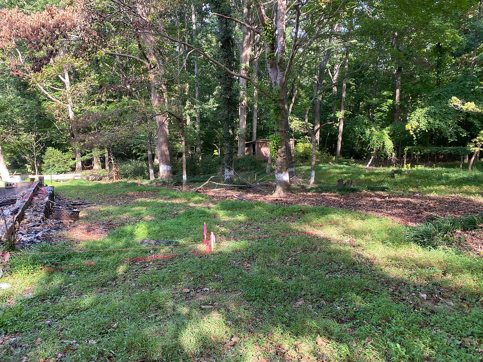
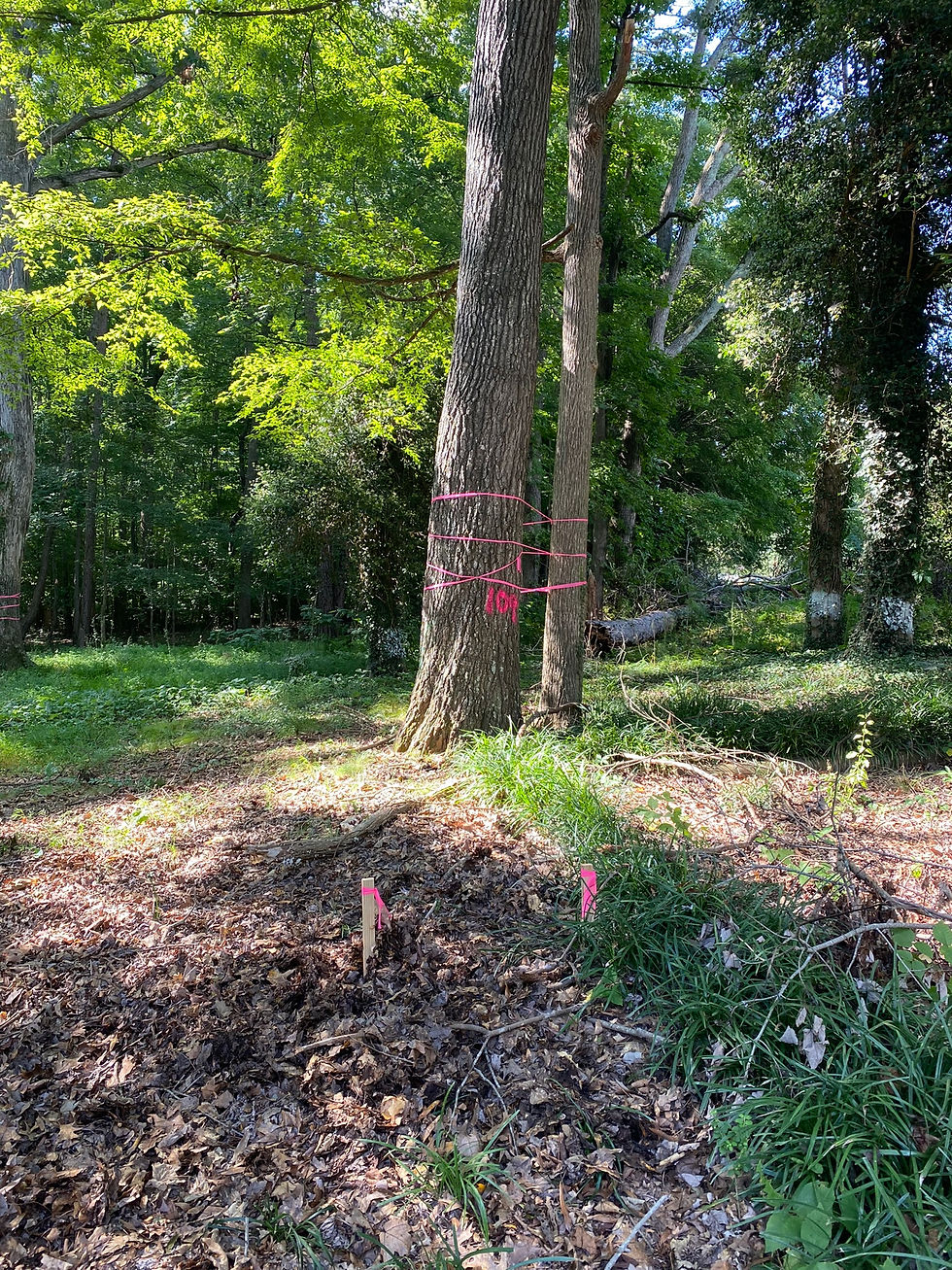
Once it was all mapped out they then took marking paint and marked lines in between the two points. They didn’t mark a lot, so I wound up going back and marking more markings over theirs to make them more visible. I also took a fluorescent mason string an and connected all of the stakes to create a 3-D outline of where both the house and the garage are going to be. What I recognize about these marking is that time is of the essence. These are not meant to be there for months, it’s meant to be there for weeks. So it's time to get the grading done while the markings are still as visible as possible.

At the end of it the survey crew's work and my enhancing of their work we now have a very visual representation of where the foundation is going. Next we’re going to dig out beyond that during grading, likely 5 feet beyond the foundation markings, as we need the additional space in order to work. But this gives a very good representation to the homeowner, as well as to the grading contractor, as to where we are going and what we are doing.

I had been out to the jobsite many times, and in my mind I had kind of mapped out where the house was going visually, where the garage would be and, which trees we’re going to have to come down and how far back the project would go. But trust me when I say there is no amount of visualizing you can do that takes the place of staking the house out with a proper survey. I will confess that I was quite surprised when it was all staked out that just visually how the house and garage sit on the lot was different than my mind's eye. There is no doubt that taking this step, rather than just going with my vision of the position of the buildings, was absolutely the right thing to do.


Comments